
Applications of drone technology in the primary industries
Drone technology has been used for military or intelligence services for decades. In recent years, corporations have started to discover them as a more economical alternative to fixed-wing and helicopters, as has the agriculture industry. The AgriBusiness Group have recognised the value that drones can add to our line of work within our consultancy and research teams and for our clients.

Application of drone technology has advanced further from just crop scouting with a regular RGB (colour) camera to the capturing of data that could otherwise not be obtained from ground-based sampling (due to the development of intelligence and sensors). Compared to the rest of the world, New Zealand agriculture has been slow to adopt the technology. This might be a result of our focus on pastoral farming as opposed to arable. However, the value of drones is becoming more and more recognised. At The AgriBusiness Group, we have identified their potential assistance in our workflow, and as a result, have invested in a drone.
How do we apply the technology at The AgriBusiness Group? Our consultancy team completes projects on a variety of farm systems and landscapes which require detailed assessment of those systems and their land management practices. The ability to utilise the services provided by a drone in these assessments has allowed us to assess, map and model landscapes of interest with greater efficiency, detail, and accuracy, which has increased our level of performance when reporting results. Farm environment plan auditing, farm environment plans, water quality assessment, erosion assessment, land use capability and environmental risk identification are all examples of our work environment where aerial photography, mapping and modelling can significantly benefit our quality of work.
We’ve identified three core capabilities that drones add to our line of work and the potential complements they can give to our current services.
Aerial Assessment and Inspection
Drones allow us to assess and inspect any landscape in real-time with aerial video and photography. Our farm environment planning team will use drones to assist in gathering evidence through photography, video or by using a live streaming platform that provides an interactive live video feed to anyone who requires access to the drone’s camera. Drones also allow efficient ease of access around a property which might otherwise be inaccessible (i.e. steep zones and wet paddocks). The ability to survey all farm areas while capturing the evidence on factors (catchment areas, water quality, land management units, non-compliance, winter grazing etc) compliments our environmental services.
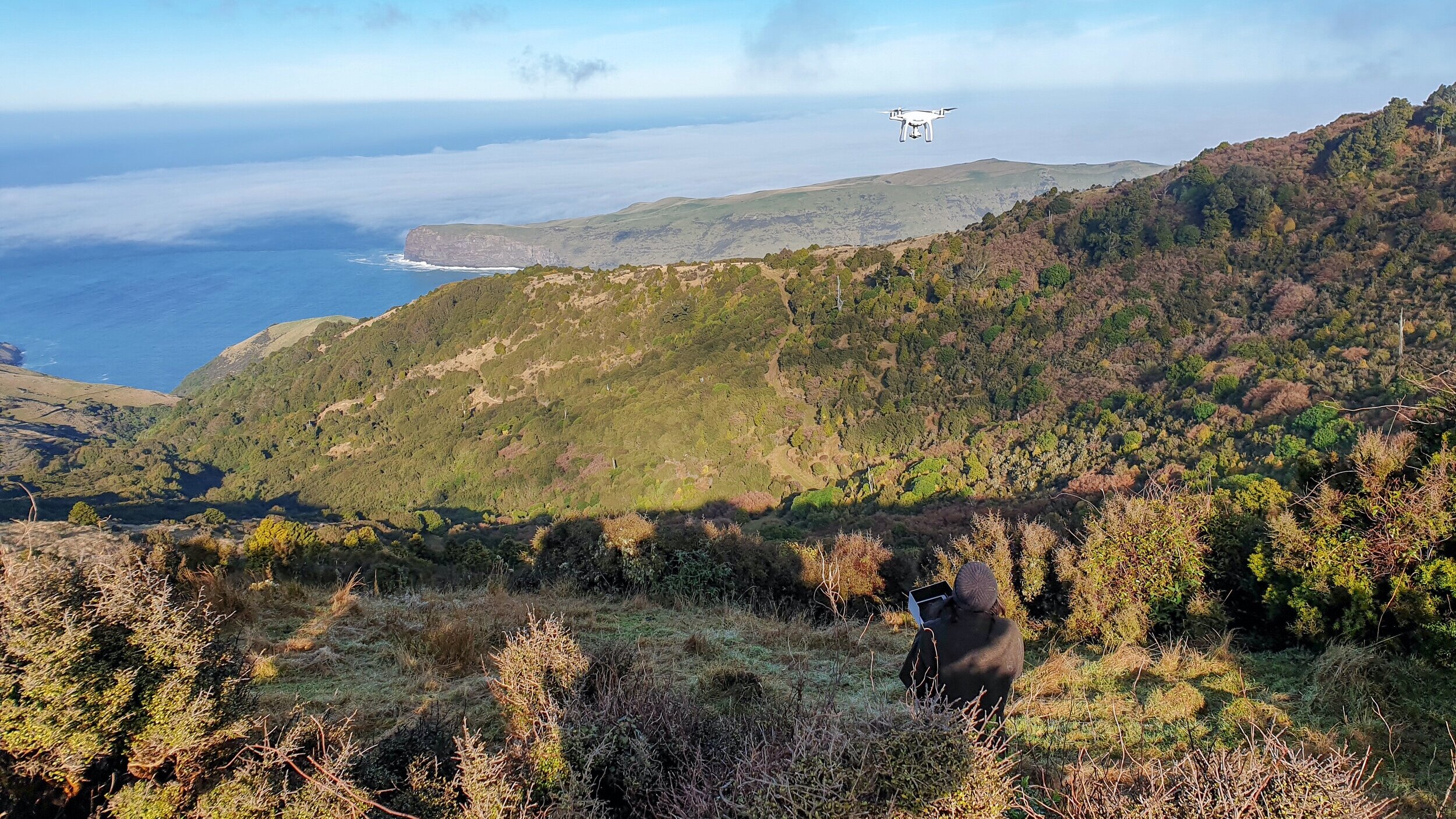
Using the drone to provide evidence on the current land use for a 1 Billion Trees application for MPI
Aerial Survey, Mapping and Modelling
Drones can be used to map an area with survey grade (2-3cm) spatial accuracy, while providing updated, high quality and accurate information about a landscape. This is a process known as orthomosaic mapping. The drone flies the piloted flight path using its integrated GPS system where it takes a series of photos which are later geo-referenced and processed into a current and measurable farm map or model. Recently, this has been a valuable tool when providing evidence to MPI for farm Emissions Trading Scheme (ETS) applications for carbon crediting, relaying high quality, current, spatially measurable land use areas of existing forestry.

The same land area mapped comparing drone imagery (left) verse satellite imagery (right)
Other work streams likely to benefit from aerial survey include resource consent applications, effective areas, hazard identification (erosion and land use capability), nutrient application management, irrigation management, fencing cost, crop areas, and feed budgeting.

We delineated data from a current (2019) drone map that we overlayed onto satellite imagery from 1989 that allowed us to interpret areas of potential post-1989 forestry registration in the ETS
Precision Agriculture
Drones equipped with advanced camera devices have allowed farmers to investigate the health of plants through different wavebands of light. Cropping farmers have benefited from this technology, as the drone data highlights areas within the cropping rotation that are displaying deficiencies in terms of yield and through other invisible measures of a plant, such as the chlorophyll content. Many of these aspects are unable to be viewed from a ground perspective or with the human eye. Research companies undertaking plant plot trials have shown large interest in using multispectral cameras for these purposes. The horticulture industry is also likely to be one that benefits from the use of aerial multispectral cameras. Locating individual trees that have disabled growth that otherwise wouldn’t have been identified is likely to be an invaluable tool.

An NDVI drone map of a cropped area. The areas shown as red indicate low biomass and the areas in green high yield
In conclusion, our investment in drone technology gives us the opportunity to improve the quality of our work of our consulting and research teams while we explore a range of drone-based services. We look forward to putting the technology to further use and keeping our clients updated on further successions for drone use in the agriculture space.


